New Interactive Map Tracks Water Safety

New Interactive Map Tracks Water Safety
May 30, 2017

Where is tap water putting children at risk and how are state leaders responding?
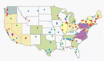
University of California Nutrition Policy Institute and the National Drinking Water Alliance just released an interactive map identifying places across the country where drinking water has been rendered unsafe to drink by lead or other contaminants. The map was created to fill a gap: there is little readily accessible information on the extent of tap water contamination across the U.S.
Each pin tells a story: you can link to news articles about drinking water contamination around the U.S. You’ll see the states that have adopted policies or programs to test for lead in schools and childcare, and the states considering such action. You can sort each incident by Congressional district. The tool bar on the upper left side provides a legend feature and a layers feature to access the different types of information.


